Beating the Heat: Heat Islands and the Importance of Trees

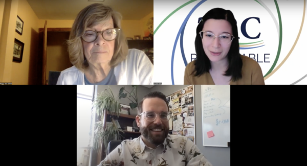
Lauren Huey, Communications Manager at Green Fin Studio, moderated the webinar and spoke with two expert speakers who discussed how increasing temperatures are overwhelming our local communities. Jeremy Hoffman, David and Jane Cohn Scientist, Science Museum of Virginia; and Peggy Van Yahres, Chair, Charlottesville Tree Commission, discussed the impacts of climate change and heat islands on the Chesapeake Bay watershed, along with possible mitigation strategies.
Takeaways from the webinar
Jeremy Hoffman (Science Museum of Virginia) is a scientist that analyzes the effects of heat as the deadliest weather-related hazard in the United States. He specifically investigates the environmental injustices associated with urban heat islands and other climate change issues (e.g. increased heat, precipitation, flooding, sea level, pollen). During the webinar, he talked about the importance of examining this issue through a historical lens of residential segregation.
- In 2017, temperatures across Richmond were measured, at the exact same time and day, during a heat wave. It was found that there was a 16 °F difference between the warmest and coolest places. Areas with higher temperatures were found to have lower tree canopy, wider streets, and smaller buildings.
- In collaboration with the Richmond Ambulance Authority, it was concluded that the hottest places in the city correspond to those areas that have higher rates of heat-related illnesses regardless of population density. When examining the race/ethnicity of these heat illness patients, it was determined that Black or African American Richmonders were disproportionately affected by heat.
- Urban heat islands are an environmental justice issue that can be linked to a history of residential segregation in the form of redlining. Today, previously redlined areas in Richmond, that still have predominantly black inhabitants, are significantly warmer due to these regions having more paved surfaces and fewer trees.
- Jeremy shared that out of all the 250 cities that were redlined, 94% of the cities showed this pattern. A later study established that 76% of all counties in the United States have a racial and economic component to exposure to extreme heat.
- There are two methods to combating urban heat – mitigation (waste heat, urban greening, urban design, and land use) and management (personal exposure, public health energy, emergency preparedness).
Peggy Van Yahres (Charlottesville Tree Commission) is seeking to increase the tree coverage in Charlottesville, VA that has been declining for years due to rapid development. Through combining her passions for education and the environment, Peggy became the chair of ReLeaf Cville which focuses on planting and preserving trees along with educating the public about the benefits of these efforts.
- From 2004 to 2022, the tree coverage in Charlottesville has declined an estimated 15% (which is equivalent to 990 acres). The current goal of ReLeaf Cville is for all areas to have at least 40% canopy coverage. However, 12 out of the 19 neighborhoods do not meet that goal and out of those 12, seven are below 30% and two are below 20%.
- ReLeaf Cville focuses on private property owners because 75% of possible planting areas are located upon these lands and the other 25% is city property which is planted by park officials.
- The benefits of increasing tree population include lowering AC bills up to 25%, reducing heat mortality with only 10% more tree coverage, and decreasing air pollution by more than 50%.
- The organization is taking action in two ways: planting in neighborhoods that have few trees and starting a fund to preserve the existing ones. Currently, a priority neighborhood is 10th and Page. This previously redlined area has one of the lowest tree canopy coverages in the city, estimated at 18%. This lack of coverage has resulted in extreme heat resulting in the city’s highest rate of heart attacks, second highest rate of asthma, and highest energy cost.
Resources for further action
Books:
Heat Wave: A Social Autopsy of Disaster in Chicago by Eric Klinenberg
Literature:
Integrating Satellite and Ground Measurements for Predicting Locations of Extreme Urban Heat, Shandas et al. 2019
How Decades of Racist Housing Policy Left Neighborhoods Sweltering, Brad Plumer and Nadja Popovich, New York Times
The Effects of Historical Housing Policies on Resident Exposure to Intra-Urban Heat: A Study of 108 US Urban Areas, Hoffman et al. 2020
Widespread Race and Class Disparities in Surface Urban Heat Extremes Across the United States, Benz and Burney 2021
Historical Redlining Is Associated with Present-Day Air Pollution Disparities in U.S. Cities, Lane et al. 2022
Planning for Urban Heat Resilience, Keith and Meerow 2022
Exploring Stakeholders’ Perceptions of Urban Growth Scenarios for Metropolitan Boston (USA): The Relationship Between Urban Trees and Perceived Density, Cheng et al. 2017
Tools:
Reforest Richmond Neighborhood Outreach Toolkit
Urban heat island severity for U.S. cities
