
Old Dominion University (ODU) oceanography professor Tal Ezer has been looking at how changes in the Gulf Stream could prove to be a wildcard in predicting flooding in Hampton Roads. In a recent article written in The Virginia-Pilot, Ezer explains how tides in the fall of 2015 rose 3 feet above predictions. During Hurricane Joaquin, winds and waves blasted against the Gulf Stream, causing the current to decelerate. This led to higher water levels in places as far away as Hampton Roads.
Climate change models predict more current decelerating in the future, which could cause 2 to 6 feet of additional sea level rise for Gulf Stream residents. As oceans warm, water expands and melts ice caps, causing additional sea level rise that threatens to disrupt ocean currents.
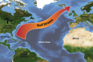
Ezer uses satellite altimetry to chart surface elevation of the Gulf Stream, documenting the slope in ocean depth. The landward side of the Gulf Stream can be up to 5 feet lower than the warmer east side, showing that the strength of the current pushes water away from coastal neighborhoods along the mid-Atlantic.
Although data is available tracking the speed of the Gulf Stream, and early analysis shows some slowdown, Ezer thinks more years, even decades, of data will be needed to say whether or not it is a trend. In the meantime, Ezer and other scientists must continue to better understand how ocean currents and coastal flooding are connected. Ezer and ODU colleague Larry Atkinson collect water current speed data through an abandoned telephone cable between West Palm beach and Grand Bahama Island. Salt particles in the water pass by the wire, sending speed data back to NOAA.
More research like this is needed to understand how huge storms like Hurricane Joaquin that don’t even touch the mid-Atlantic could still cause flooding problems across the east coast.
Original article by Dave Mayfield