
Targeting Resources to Accelerate Chesapeake Bay Restoration
Denice Wardrop,Executive Director of the Chesapeake Research Consortium, moderated the webinar featuring two experts from USGS. Scott Phillips, Chesapeake Bay Program (CBP) Coordinator for the USGS, and John Wolf, Assistant Director, Land Change Research, Hydrologic Transport and Response, USGS, gave an overview of tools for targeting Chesapeake resources and highlighted several approaches and possible combination of tools to enhance resources and increase collaboration.
Takeaways from the webinar
Scott Phillips shared a presentation on the science approach for targeting resources.
-
The science approach for the Accelerated Conservation and Restoration tools portal incorporates a lens of climate resiliency and accordingly divides the Chesapeake Bay Agreement goals into 5 categories that seek to achieve multiple benefits for the Bay
-
The targeting portal can be used to address multiple outcomes. Using Lancaster County as an example, Scott showed how to use various tools (including the Most Effective Basin Map, a map of disadvantaged communities, and ag priority watersheds) to achieve multiple outcomes (Bay TMDL, Diversity, Stream Conditions, and Forest Buffers). The results from those tools can be used to coordinate programs and ultimately gain funding.
-
Collaboration between different levels of government is of primary importance
-
-
Engaging with the benefits between outcomes will accomplish more than just looking at each outcome independently
John Wolf demonstrated how to use the Accelerated Conservation and Restoration tools portal.
-
The portal, available at gis.chesapeakebay.net/targeting, highlights important tools and how to combine them
-
Priority areas: 1) water quality improvement, 2) fish, wildlife, and habitats, 3) land conservation, and 4) increased benefits to people. Each priority section includes need, applications, opportunities for future use, decision-tree, and a list of topics with examples for each type of tool
-
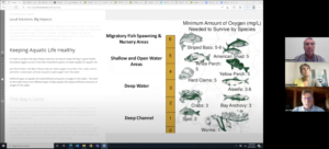
Example of the Watershed Resources Registry tool to stress the importance of collaboration between organizations, like EPA and states, for developing tools to actually help achieve outcomes shown through exploration of several different GIS tools including: Watershed Data Dashboard for Water Quality in Rivers and Steams, Most Effective Basins, and Fish Passage Prioritization Tool
-
“Geography is the common currency.” As an important mindset to understand how different initiatives and people working on them from different perspectives is helpful to achieve the multiple outcome approach needed
Resources for further action
The Accelerated Conservation and Restoration tools portal: Better Targeting CBP Resources to Achieve Multiple Outcomes: Approach and Tools
Background on the project: A Science-Based Approach for Targeting Resources to Achieve Multiple Chesapeake Outcomes
StoryMap: Local Solutions, Big Impacts
Related Webinars
Listening and Learning: Achieving Environmental Wins Through Convening
Behavior and the Bay: The Human Dimension of Chesapeake Bay Restoration